What we do
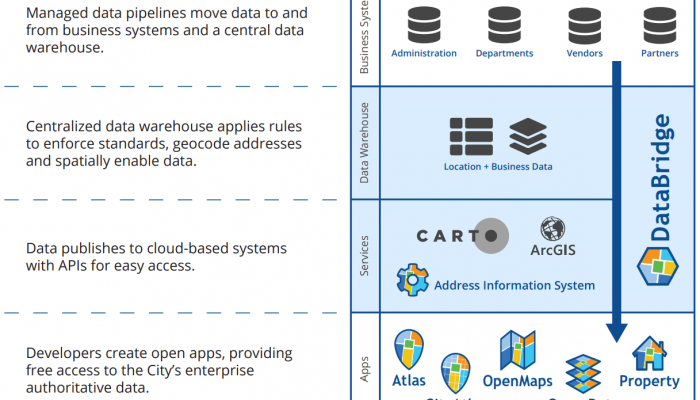
CityGeo helps departments share data used for mapping, analysis, and city services. Our team of analysts, application developers, and project managers:
- Creates applications to analyze and show geographic data.
- Performs geographic and statistical analyses for departmental projects.
- Publishes much of the geographic data created by city departments as open data.
- Coordinates major spatial technology contracts for the City.
- Manages large data integrations.
- Supports standards for how geographic data is mapped, shared, and managed.
Connect
|
maps |
|
| Social |
Our programs
Posts
Staff
Sorry, there are no results for that search.


