As part of #VisionZeroPHL Pedestrian Safety Month 2021, the City released today two transportation studies: The Vision Zero Pedestrian Safety Study and Action Plan & the Philadelphia’s Transportation Data Roadmap. Both studies were completed by the City in partnership with the Delaware Valley Regional Planning Commission (DVRPC).
Vision Zero Pedestrian Safety Study and Action Plan
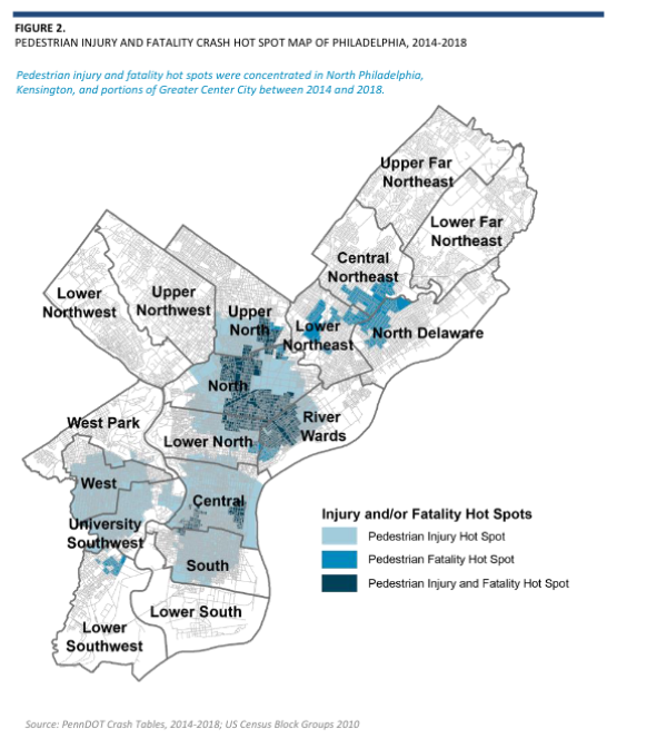
Walking in Philadelphia is often a wonderful experience, but it can also be challenging and sometimes even deadly. A pedestrian is injured or killed in the City every six hours. Compared to similar U.S cities, Philadelphia has a higher number of pedestrian fatalities per resident. In 2019 the City undertook a study to better understand pedestrian crashes and actions to prevent them.
Key actions coming from this study inform the work the City is undertaking to ensure all Philadelphians can walk safely. Highlights include:
- Reducing vehicle speeds using tools like camera automated speed enforcement, narrowing lanes and roadway space, and speed limit reductions;
- increasing visibility with physical features of the road to make drivers see pedestrians easier such as high visibility crosswalks, raised intersections, lighting, and restricting parking near intersections so pedestrians and drivers can see each other instead of being blocked by cars;
- reducing pedestrian crossing widths by installing median islands, adding curb extensions and making turns tighter for people driving, and narrowing lanes or reallocating roadway space;
- reducing conflicts between people walking and people driving by installing protected walk phases on traffic signals, and restricting people driving from turning right when they have a red light.
The study analyzed crash data to determine the highest priority locations for the City and partner agencies.

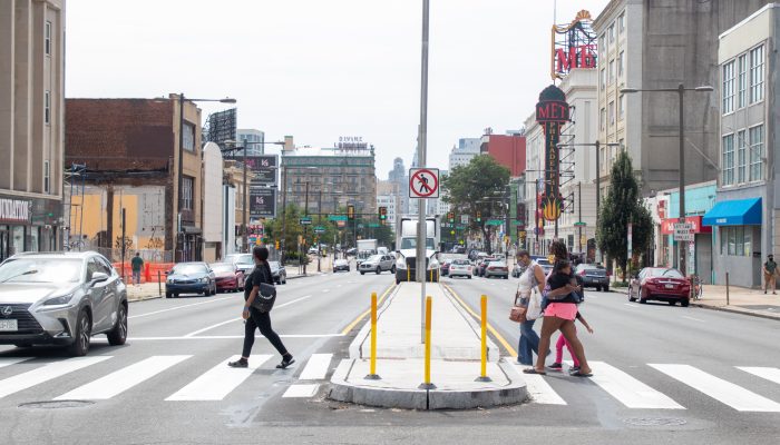
As an action to implement the findings from this study, the City installed pedestrian median islands on North Broad Street, one of the locations that rose to the top of the list for pedestrian crashes. These new islands were installed on the corridor from Poplar Street to Cecil B. Moore Avenue and provide a safer place for people to stand as they cross the street.
Philadelphia’s Transportation Data Roadmap
A revolution in mobility around the world has brought new travel options for people to move around cities. One key to the high adoption of new options has been the effective use of data to support near real-time matches between customers and suppliers of mobility service and/or travel information. Such mappings establish a potentially continuous feedback loop between user’s needs and changes in service for both private and public service providers.
This revolution prompted cities all over the world to rethink their policies around the use of data, not only to make existing travel options more resilient but also to support better use of public infrastructure for a variety of needs. But leveraging this potential fully means satisfying important prerequisites.
This project, Philadelphia’s Transportation Data Roadmap, takes a first pass at assessing, aligning, and developing the capability of the City and its partners to collect and use data in support of multimodal transportation. The roadmap identifies the type and level of effort required by all partners to support the goals and objectives of Connect: Philadelphia’s Strategic Transportation Plan and the elements described under the goal ‘a Competitive City.’
This project is the first step towards three overarching goals:
- Encourage and improve processes for data-driven decisions.
- Expand interagency coordination by sharing data infrastructures across agencies.
- Prepare a foundation for tools to improve user experience.
Through this project, two specific pilot projects have been identified that would help move forward on all these goals in a systematic way while improving data-driven coordination among partner agencies. The first pilot plans to reduce bus detours and inconvenience caused due to them to many commuters every day by improving upon the existing Street Closure Permitting System managed by City’s Streets Department. The second pilot aims to use new curb-mapping technology to generate a digital map of types of curbside uses and leverage it to pilot “smart” loading spaces that will allow reservation-based loading activity at designated spaces.
The studies were funded by the Transportation & Community Development Initiative (TCDI). This program supports local agencies to achieve goals such as improving the overall character and quality of life by enhancing the existing transportation infrastructure.


